A picturesque
mountain hovering above the Olympic Rainforest and Lake Quinault, Colonel Bob
sits high above a horizons worth of lush, blanket like, Evergreen trees. The
weather could not have been better. Fall days on the Olympic Peninsula are
reasons for depression and Shades of Grey, read into that as you will. Olympia,
which is 100 miles away, is the perfect spot to launch a day climb. In just
short 2 hours you could be on the trail, on an adventure to climb a rugged,
isolated mountain in the Pacific Northwest.

Colonel
Bob, named after Colonel Robert “Bob” G. Ingersoll (a fascinating Civil War
veteran and political leader), is the 2nd tallest peak in the
Colonel Bob Wilderness. At 4, 592 feet above sea level, this peak allows for
unrivaled views of the Olympic Peninsula. Located on the southwest side of the
park, views include the Pacific Ocean, Grays Harbor, Lake Quinault and the
Quinault River, the Olympic Rainforest and Mount Olympus. During the last tour
we took up here, one visitor remarked they were breathless and almost to tears
the view. With a steady 4 mile climb with average views, the top of the
mountain arrives out of nowhere; bring pleasures to your eyes that cancel out
the tiredness of your legs. The climb itself is pretty enough, but the moment
you summit, the view is spectacular. As someone who has climbed numerous
mountains around the country, this view is one of my favorites. On the first
fold of peaks that increase as you reach Mt. Olympus, being able to see an
endless sea of ridges and mountains to climb gives me nothing but excitement to
explore more. The peak area is wide enough to have a picnic, pose for pictures
and just lay back taking in the panoramic beauty.
At just
8 miles, round trip, this climb is difficult. Saying this hike is strenuous is
accurate. While some may consider this a day hike, be prepared to sweat no
matter what the weather. The trail is best if broken into 4 almost equal parts
(Located below), each with its own unique advantages and disadvantages. At a
steady pace, you can climb up in about 3 hours and descend in 2 hours.
Part 1: Pete’s
Creek/Colonel Bob Parking Lot to Pete’s
Creek
 |
| Sign in! |
After
arriving and hopefully using the last bathroom, the trail to climb Colonel Bob
is located on the other side of the road as the bathroom. While there is a
trail on this side, do not go downhill! Pete’s Creek/Colonel Bob trail is a
little hard to see, but trust me, it is there. Sign in at the sign in sheet
located about 1/10th of a mile from the road and head on up. This
section, with 500 feet of elevation gain in 1 mile, is in trees and the trail
is rocky and full of roots. Pete’s Creek isn’t labeled, but it is the mostly
dry river bed located a few hundred feet passed a large washout on the trail. Enjoy
this part because it is the least steep section.
Part 2: Pete’s Creek
to Colonel Bob Trail
 |
| Pete's Creek (usually Dry) |
This
second section is 1.4 miles long and works its way more directly up hill, with
short switchbacks and over 1000 feet gained. It is highlighted with areas of
tree thinning and views of the valleys behind you. The final push to the
crossroads is highlighted by a steep, and depending on the season, lush slide
area that you cross before you arrive. With good views finally emerging, this
is a great place to rest, hydrate and cool down before the last 2 stages.
Part 3: Trail
Intersection to “Julie Andrew’s Valley” (my name for it)
 |
| View from Julie Andrews to Colonel Bob |
 |
| Trail has good signs! |
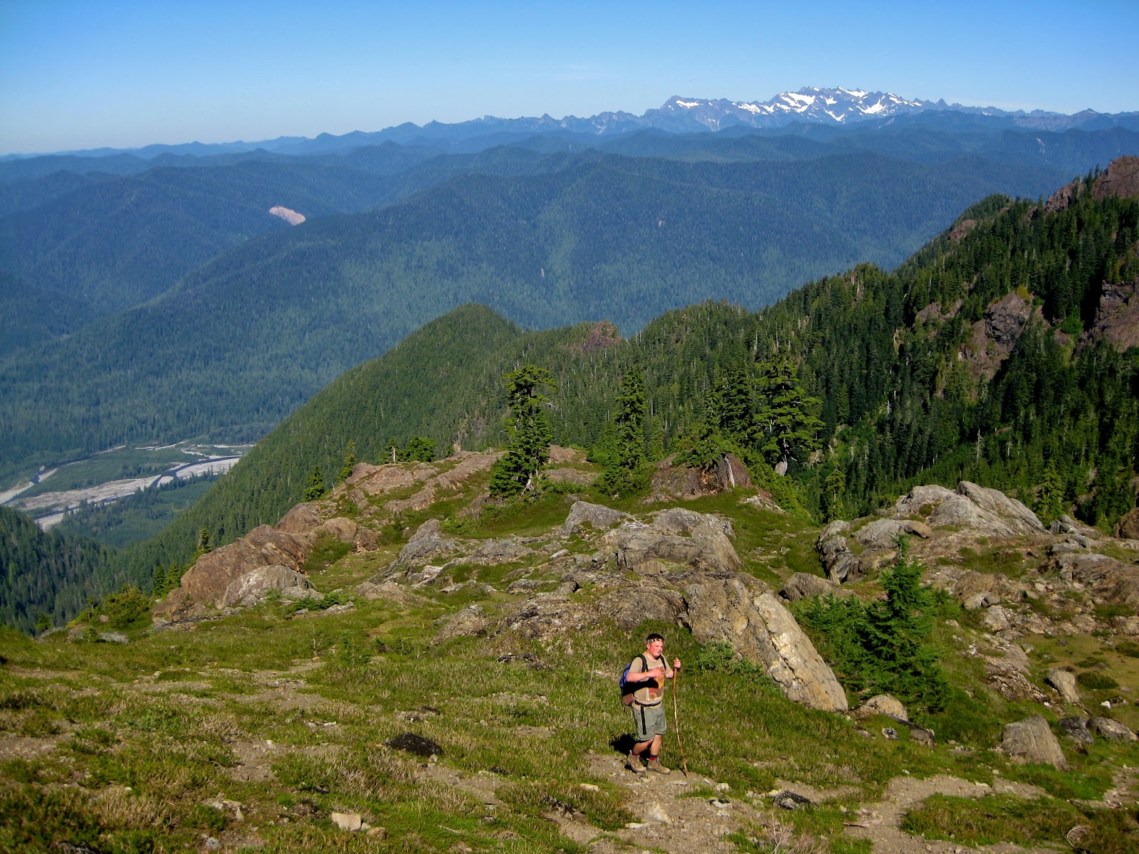
A
rewarding section of trail starts out crossing in and out of trees, continuing
the climb. While still in trees, the
trail itself is a lot rockier and one needs to be careful to avoid rolling an
ankle. Also, some of the steps up along the trail are steep, so use those
walking sticks and poles. If you are over 6 feet tall though, this should not
be a problem. After a little more than a
half mile and an elevation gain of over 500ft, this section gets into the only
true meadow on the mountain. Coming up around a well timbered area, you come
into an area with large boulders, small mountain lakes and picturesque places
to rest. I suggest taking a snack break here, drink some water and rest for a
few. You don’t need to impress anyone, take care of your body.
Part 4: “Julie
Andrew’s Valley” to Colonel Bob Peak
 |
| The saddle |
 |
| Lake Quinault, The Hoh Rain-forest and the Pacific Ocean |
 |
| Olympia's new Home Mountain |
This final stretch is not a
technical climb, but it can be somewhat difficult for inexperience hiker
because the trail is a steep. Slow, well placed steps are all that is needed
though, so no worries. In about a half mile you arrive at a saddle between a
few nearby peaks. There is also a boulder filled small valley between peaks
that is quite awesome. However, only take a short rest here, as the trail continues
up, you finally round a corner that will take your breath away. The last few
hundred feet are somewhat of a scramble, but the view makes the hard work pay
off. The view from the top is a full panoramic view of the Olympic Peninsula,
the Pacific Ocean, Grays Harbor and more. While your legs may be burning, this
is the moment that you crave, the moment that gives your hiking a purpose, the
view that will give you memories through the rainy days and work. Colonel Bob
Peak, while only 4,492 feet, gives you world class views only a few hours from
home.
 |
| Partial View from the top of Colonel Bob |
 |
| Mount Olympus and the peak of Colonel Bob |
Suggested Items to
bring
-
Water
-
Water
-
Gatorade
-
Weather appropriate clothes
-
Camera
-
Walking Stick or trekking poles
-
Backpack
-
Food
-
Bandana or hat
-
Sunscreen
-
Good Shoes
-
Extra socks and shoes/sandals in the car
-
Some moxie
Directions:
From Aberdeen, Washington, head
north on Highway 101. About 27 miles later, take a right at Donkey Creek Road,
also known as FSRD 22. The road will be paved for 8 miles until you hit an intersection.
Turn left on this road and follow the well-marked signs for “Pete’s Creek.” In
11 miles, you will see a restroom and trailhead on your right. This is your
stop. Remember, the trail to Colonel Bob is on the opposite side of the road as
the bathroom. Do not go downhill.
As always, tell someone where you
are going, or better yet, give us a call and we can take you up safely and
awesomely!
Until next time,
Douglas Scott
Exotic Hikes (360)350-8938
Shelton Matlock road and Cougar Smith road will get you there quicker than driving through Aberdeen.
ReplyDeleteAwesome to know! Thanks!
ReplyDelete