If you are subscribed to my blog...It has been moved to my new website at http://exotichikes.com/?page_id=8
Check out the whole thing and tell me what you think!
Thursday, October 25, 2012
Thursday, October 4, 2012
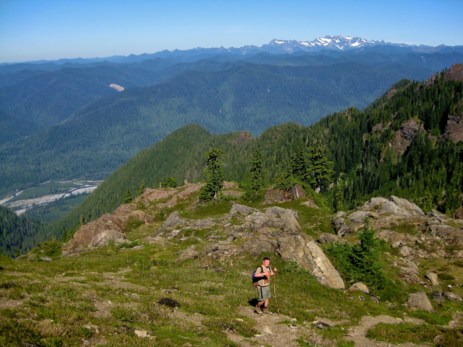
The Men Who Stare at Goats: Mt Ellinor Trip Report and Mountain Goat Report
 |
| Forest Service watching goats |
If I could type in the Movie
Preview man’s voice, I would do that and say “For three months, the trail had
been closed to the public. Barriers were put up; police and Forest Service
rangers were put on notice to not allow anyone in the area. For three month,
aggressive mountain goats were running amok, after attacking, charging and
once, even killing a tourist. They had taken one life, would they take more.
For three months, one man summited the mountain on a daily basis, hoping to rid
the area of the problem. For three months, he was ‘The Man Who Stared at Mountain
Goats”
I would
say that because, for the first time in 3 months, the trail up Mt Ellinor is
open. For the most part, closing on account of numerous reports of aggressive
Mountain Goats is a good idea, especially since a man a few years ago was gored
in his femoral artery and was killed by a goat on the North side of the Olympic
National Park. Deaths in a park are never good, and putting the area on high
alert was a great decision. Mt. Ellinor is by far the most popular peak on the
Olympic Peninsula. It is used as a training run for Cross Country teams, a
winter wonderland for new climbers and a great day hike for thousands each
month. At 1.6 miles long and an elevation gain of over 2,400 feet from the
upper parking lot trailhead, this is a short but strenuous trail.
With
Port-A-Potties located at the parking lot, the issue of the goats could become
better, as mountain goats are attracted to salt, and, well, urine is quite
salty. The restroom had been removed the year before because of budget allotment.
With the winter snow not melting off for
over a year, the goats’ salt from rocks and lichen were not as available, so
the salts from the bathroom in the parking lot became a new destination. The
goats were reportedly following people down the trails, taking food from their hands.
As I was talking about this with Forest Service Rangers, a fellow hiking from
Ballard was expressing his sadness for not “being able to feed the goats lunch
anymore.”
 |
| Follow all signs |
Because
of interaction with some hikers, who tended to view wildlife as tame and safe,
the mountain goats got used to human contact. Just like with bears, deer, elk
and even chipmunks, too much contact between animals and humans can cause
problems. The mountain goats got too used to people and with their ability to
cause fatal injuries; something had to be done with the Mt. Ellinor area goats.
This is when the Forest Service sent up an employee to scare away and create a
natural fear between goats and humans. The employee, who shall remain nameless
at his request, used a myriad of methods to scare away the goats. From Bear
Spray to throwing rocks and shooting paint balls at mountain goats, he tried
practically everything he could think of to scare them away. For the most part
though, the goats left him alone. Discussing this with him, we agreed that if
people realized they were wild animals, and treated them as they would treat
coming up on a bear during a hike, they never would have become a problem. Another
hiker, listening in to our discussion, chimed in with a rule that is somewhat
appropriate for the situation.
 |
| This is Mountain Goat Country |
He said that “Hikers need to be respectful of nature and understand her, and stop being dicks and ignoring rules.” I mention this because his comment shows the dichotomy of hiking. To balance nature with human activity is nearly impossible. We impact nature with just our mere presence. We are no different to these goats when we encroach on them as wolves are while hunting a herd of elk. They act differently when their world is disturbed, and we need to, as hikers, climbers and stewards of nature need to continue to be respectful. Enjoying nature is easy, follow all signage, follow common sense and be smart.
 |
| Keep on eye out for these guys |
All of that had to be said, in order
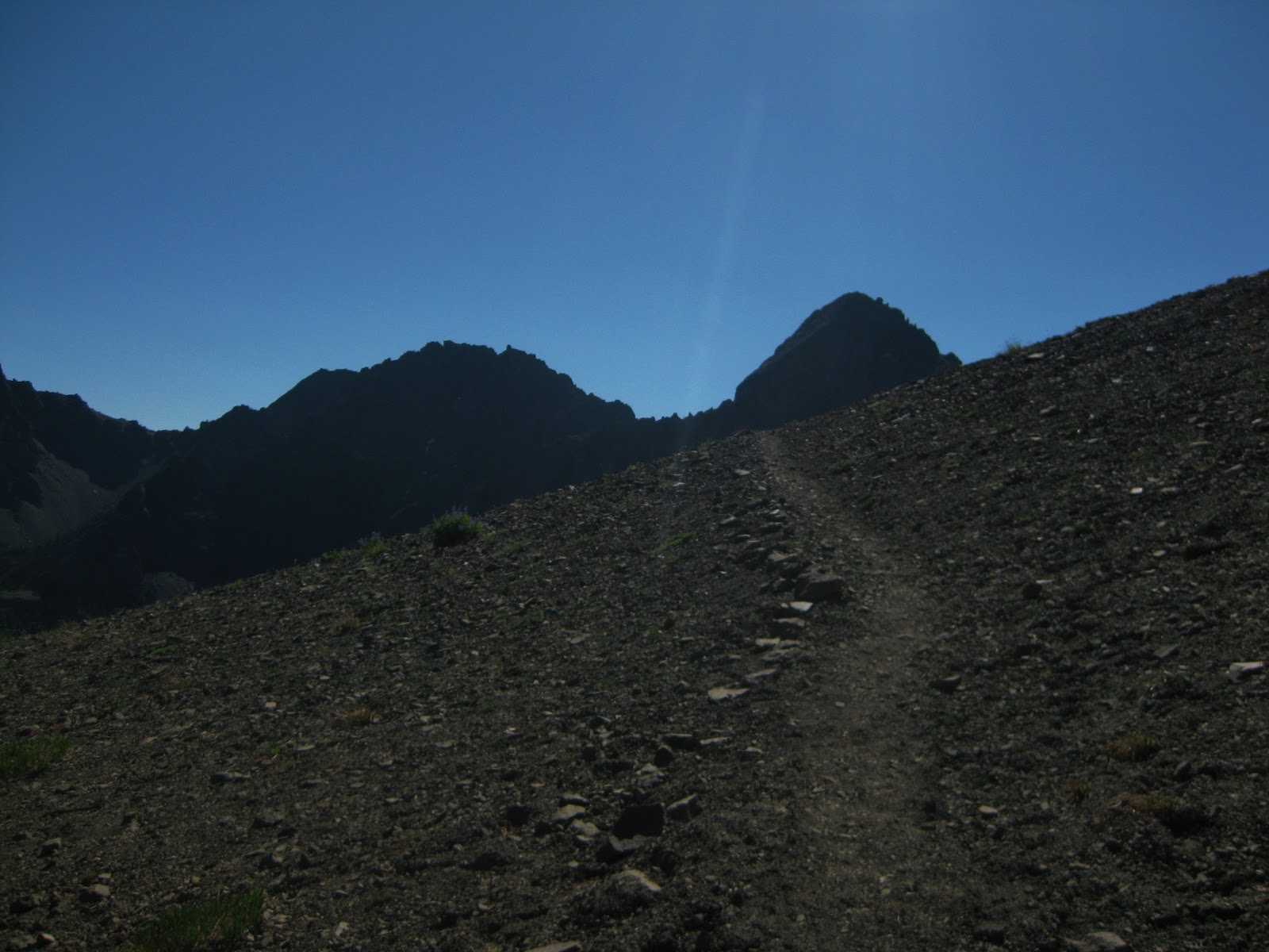
to tell you this: Mt Ellinor is open to hiking and climbing. It is a beautiful,
short but strenuous trail that is broken up in to 3 parts. From loose rocks,
called scree, wide trail with vistas that are easy to walk, to switchbacks
through lush green and brown forests, this trail has it all.
 |
| Lake Cushman and Mt Ellinor (Right) |
Location and Directions: About 60 miles from Olympia take Highway 101 to Hoodsport. Turn left and follow
signs to Lake Cushman and Staircase. Follow road until you reach a T where you can
go to Staircase to the left or Mt Ellinor to the right, turn right. After about
4 miles, turn left to go uphill. Signs are visible. Follow road up for about 5
miles. Take another left after giant pile of rocks and sign for Mt Ellinor.
Trailhead is near Port-A-Potties
Level: Strenuous at time- Bring Walking sticks and plenty of water
Distance: 1.6 miles from upper parking lot
Elevation gain: 2400ft (3500-5900ft)
Bathrooms: Available at Trailhead. If you need to expel waste, do
so 50 feet from the trail and on a rock or snow patch.
Trail Breakdown: 3 main sections
-Section 1: .30 miles of a straight up
trail in a dense forest and well-marked trail. Elevation gain is 400ft.
-
Section 2: .70 miles of switchbacks
through a forest. Rest benches are available, as you gain 600 feet. Loose
pebbles and dirt can cause spots where the trail is loose. Great views are
available at the top of this section.
 |
| Take a break, enjoy the view |
- Section 3: .60 miles of scree and
steps carved into rock. This has an elevation gain of over 1400ft, so take your
time. In some areas, the rock is a little loose, so test your steps before you
commit. Despite the difficulty, amazing views unfold nearly every step.
Mountain Goat encounters in this section are possible, so keep an eye out.
 |
| An average view from the summit |
- Summit: From here on a clear day, it
is possible to see more than just the city of Seattle, Mt Olympus, Mt Baker, Mt
Rainier, Mt Adams and Saint Helens, the Capitol Dome in Olympia, Hood Canal and
the Puget Sound. Hawks, birds, goats and chipmunks are also frequently seen. As
usual, keep all trash in your bag, and keep it zipped; the chipmunks know what is
inside.
 |
| Join us on Mt Ellinor! |
Final Thought: You
MUST hike/climb this sometime. It is difficult, but hikers of all levels can do
this. Sure, you might be a little tired or have small muscle aches, but the
views from the top and the feeling of accomplishment make up for everything.
Call us today to
come hike this trail with us. (360)350-8938
Exotic Hikes
Thursday, September 27, 2012
Shades of Grey: A Fall Guide to the Olympic Peninsula
Even though the last warm rays of summer are a thing of the
past and leaves are starting to change into beautiful oranges and reds, things
are just heating up on the Olympic Peninsula. Fall on the Peninsula is the
reason we have lush green mosses and ferns littering the floor of the forest.
From the steady dripping of water through the canopy, to the snow packed
mountain peaks and rivers running near freezing, fall on the Olympic Peninsula
is truly a rainforest. Fall on the Olympics is a wet, wild and cold time, but
this doesn’t mean that you should stay away. In fact, despite getting upwards of
100 inches of rain a year and grey skies nearly every day, this area has plenty
to do for all levels of explores, hikers and climbers. Below are some
opportunities, events and destinations for the fall. Through the 50 shades of grey
in the fall and winter sky, tourism on the Olympic Peninsula is an attractive
location.
Clam Digging
 |
| Razor Clam Season is here! |
With clam season just around the corner, there is no better
way to experience ce the Washington coast then grabbing a shovel, a pair of
boots and a jacket and clamming along the Pacific Ocean. The best beaches are located
north of Ocean Shores, making it an easy half to full day trip from Olympia. A
permit is required, but can be picked up HERE. The season this year starts
October 13th through the 18th and may be extended. A detailed
schedule can be found HERE, as well as tide information.
Clamming is a great way to spend a morning or an evening.
Sure, it is cold and you might get a little wet, but the experience is one you
will remember and enjoy, as you share your freshly caught clams in delicious
chowder, regaling your friends and family with the day’s events. Contact EXOTICHIKES today to set up a trip to go clamming.
Storm Watching
 |
| Stormy Day from Neah Bay |
With up to 6 inches of rain in a 24 hour period and winds sometimes
gusting up to 70+ miles an hour, the fall and winter on the Olympic Peninsula
can get quite stormy. Your first reaction may be to sit inside drinking tea and
reading a book, far away from this area. We ask you to step out of that comfort
and come to the coast. The Washington coast during a storm is one of the most magnificent,
beautiful, violent and relaxing things one can do. While these words may not
seem to all fit together, the Olympic Peninsula and the Washington coast
combines wind, rain and waves with beauty and sophistication at many fine
establishments. From Kalaloch Lodge and
Iron Springs, to any number of hotels in Ocean Shores, taking in a winter storm
with your significant other can turn a romantic getaway into a weekend to
remember. If you are single, it provides a great backdrop to get away from it
all, kick back with a glass of wine or a beer, and listen to the waves, the
rain and the rain all around.
See storm waves crash at the remote Neah Bay or the
picturesque Ruby Beach. Collect shells, agates and more during low tide. Contact Exotic Hikes for more information on weather conditions, lodging and
transportation needs.
Salmon Season
 |
| Salmon in the Rain Forest |
With Salmon already making their way upstream, now is the
time to walk into the rainforest and see salmon making their way up swollen
streams and rivers. Returning to their traditional spawning grounds, Salmon on
the Olympic Peninsula provide not only a delicious food source, they also allow
one to step back into the past and witness events that have been going on for
ages. Exotic Hikes is proud to offer tours into the peninsula to see salmon
swimming through the rainforest. Nothing is quite as remarkable as seeing scarlet
red salmon swimming up a small stream next to giant cedar trees and ferns.
From
October to December, salmon infiltrate the waters into the rainforest, giving you
an experience like no other. This is a great trip for families, couples and
singles, so gives a call and we will work with your schedule!
Birding
 |
| Eagles on the Peninsula |
With the salmon come the bald eagles. Believe it or not,
locals on the Olympic Peninsula can see a Bald Eagle with little to no effort
nearly every single day. This number increases, as the salmon return to spawn
and die on the rivers all over the peninsula. Eagles, 10’s at a time, sit along
the river banks, catching and eating fresh salmon, as well as posing for
numerous photographs. The Olympic peninsula is full of Bald Eagles, but no time
is better than during salmon season.
 |
| Snowy Owl in Ocean Shores |
Eagles are not the only thing to frequent the Olympic
Peninsula. Migratory birds, from around the world, travel through the region,
giving birders amazing views of everything from geese and ducks to Snowy Owls.
Birding on the Peninsula is great, with numerous wildlife refuges and frequent
migration areas; this is your place for the birding experience of the year.
Contact us for more information!
Hiking
 |
| Typical Trail on the Peninsula |
Despite the weather, numerous hikes enter the rainforest,
allowing for a somewhat dry hike in the rain. Also, contrary to popular belief,
the Olympic Peninsula, with all of its rain, has many great weather days. With
thousands of trail options, a hike for your mood and the weather can easily be
found. From climbing mountains of anywhere from four to eight thousand feet, to
walks in the dense rainforest, your desires can be met. Waterfalls, full of
rainwater, cascade down remote rock faces all over the Olympic Peninsula,
giving you a myriad of options for great day hikes all over the region.
 |
| Pony Bridge, Olympic National Park |
No matter what you want this winter and fall, Exotic Hikes
and the Olympic Peninsula have you covered. Contact us today for detailed
rates. Remember, we are not only your most passionate guides on the Olympic Peninsula,
but also able to work with your schedule, making us the most flexible.
Exotic Hikes
(360)350-8938
exotichikes@gmail.com
Facebook: https://www.facebook.com/pages/Exotic-Hikes/117153065007058
Twitter: @ExoticHikes
Wednesday, September 19, 2012
Colonel Bob Peak and Pete's Creek Trail Detailed Report
A picturesque
mountain hovering above the Olympic Rainforest and Lake Quinault, Colonel Bob
sits high above a horizons worth of lush, blanket like, Evergreen trees. The
weather could not have been better. Fall days on the Olympic Peninsula are
reasons for depression and Shades of Grey, read into that as you will. Olympia,
which is 100 miles away, is the perfect spot to launch a day climb. In just
short 2 hours you could be on the trail, on an adventure to climb a rugged,
isolated mountain in the Pacific Northwest.

Colonel
Bob, named after Colonel Robert “Bob” G. Ingersoll (a fascinating Civil War
veteran and political leader), is the 2nd tallest peak in the
Colonel Bob Wilderness. At 4, 592 feet above sea level, this peak allows for
unrivaled views of the Olympic Peninsula. Located on the southwest side of the
park, views include the Pacific Ocean, Grays Harbor, Lake Quinault and the
Quinault River, the Olympic Rainforest and Mount Olympus. During the last tour
we took up here, one visitor remarked they were breathless and almost to tears
the view. With a steady 4 mile climb with average views, the top of the
mountain arrives out of nowhere; bring pleasures to your eyes that cancel out
the tiredness of your legs. The climb itself is pretty enough, but the moment
you summit, the view is spectacular. As someone who has climbed numerous
mountains around the country, this view is one of my favorites. On the first
fold of peaks that increase as you reach Mt. Olympus, being able to see an
endless sea of ridges and mountains to climb gives me nothing but excitement to
explore more. The peak area is wide enough to have a picnic, pose for pictures
and just lay back taking in the panoramic beauty.
At just
8 miles, round trip, this climb is difficult. Saying this hike is strenuous is
accurate. While some may consider this a day hike, be prepared to sweat no
matter what the weather. The trail is best if broken into 4 almost equal parts
(Located below), each with its own unique advantages and disadvantages. At a
steady pace, you can climb up in about 3 hours and descend in 2 hours.
Part 1: Pete’s
Creek/Colonel Bob Parking Lot to Pete’s
Creek
 |
| Sign in! |
After
arriving and hopefully using the last bathroom, the trail to climb Colonel Bob
is located on the other side of the road as the bathroom. While there is a
trail on this side, do not go downhill! Pete’s Creek/Colonel Bob trail is a
little hard to see, but trust me, it is there. Sign in at the sign in sheet
located about 1/10th of a mile from the road and head on up. This
section, with 500 feet of elevation gain in 1 mile, is in trees and the trail
is rocky and full of roots. Pete’s Creek isn’t labeled, but it is the mostly
dry river bed located a few hundred feet passed a large washout on the trail. Enjoy
this part because it is the least steep section.
Part 2: Pete’s Creek
to Colonel Bob Trail
 |
| Pete's Creek (usually Dry) |
This
second section is 1.4 miles long and works its way more directly up hill, with
short switchbacks and over 1000 feet gained. It is highlighted with areas of
tree thinning and views of the valleys behind you. The final push to the
crossroads is highlighted by a steep, and depending on the season, lush slide
area that you cross before you arrive. With good views finally emerging, this
is a great place to rest, hydrate and cool down before the last 2 stages.
Part 3: Trail
Intersection to “Julie Andrew’s Valley” (my name for it)
 |
| View from Julie Andrews to Colonel Bob |
 |
| Trail has good signs! |
A
rewarding section of trail starts out crossing in and out of trees, continuing
the climb. While still in trees, the
trail itself is a lot rockier and one needs to be careful to avoid rolling an
ankle. Also, some of the steps up along the trail are steep, so use those
walking sticks and poles. If you are over 6 feet tall though, this should not
be a problem. After a little more than a
half mile and an elevation gain of over 500ft, this section gets into the only
true meadow on the mountain. Coming up around a well timbered area, you come
into an area with large boulders, small mountain lakes and picturesque places
to rest. I suggest taking a snack break here, drink some water and rest for a
few. You don’t need to impress anyone, take care of your body.
Part 4: “Julie
Andrew’s Valley” to Colonel Bob Peak
 |
| The saddle |
 |
| Lake Quinault, The Hoh Rain-forest and the Pacific Ocean |
 |
| Olympia's new Home Mountain |
This final stretch is not a
technical climb, but it can be somewhat difficult for inexperience hiker
because the trail is a steep. Slow, well placed steps are all that is needed
though, so no worries. In about a half mile you arrive at a saddle between a
few nearby peaks. There is also a boulder filled small valley between peaks
that is quite awesome. However, only take a short rest here, as the trail continues
up, you finally round a corner that will take your breath away. The last few
hundred feet are somewhat of a scramble, but the view makes the hard work pay
off. The view from the top is a full panoramic view of the Olympic Peninsula,
the Pacific Ocean, Grays Harbor and more. While your legs may be burning, this
is the moment that you crave, the moment that gives your hiking a purpose, the
view that will give you memories through the rainy days and work. Colonel Bob
Peak, while only 4,492 feet, gives you world class views only a few hours from
home.
 |
| Partial View from the top of Colonel Bob |
 |
| Mount Olympus and the peak of Colonel Bob |
Suggested Items to
bring
-
Water
-
Water
-
Gatorade
-
Weather appropriate clothes
-
Camera
-
Walking Stick or trekking poles
-
Backpack
-
Food
-
Bandana or hat
-
Sunscreen
-
Good Shoes
-
Extra socks and shoes/sandals in the car
-
Some moxie
Directions:
From Aberdeen, Washington, head
north on Highway 101. About 27 miles later, take a right at Donkey Creek Road,
also known as FSRD 22. The road will be paved for 8 miles until you hit an intersection.
Turn left on this road and follow the well-marked signs for “Pete’s Creek.” In
11 miles, you will see a restroom and trailhead on your right. This is your
stop. Remember, the trail to Colonel Bob is on the opposite side of the road as
the bathroom. Do not go downhill.
As always, tell someone where you
are going, or better yet, give us a call and we can take you up safely and
awesomely!
Until next time,
Douglas Scott
Exotic Hikes (360)350-8938
Sunday, August 19, 2012
Buckhorn Wilderness Backpacking: Part 2
Part 2
 |
| Signage and the Olympic Range from Marmot Pass |
 |
| Mt Constance in the distance |
 |
| Shadows over the Olympics |
This feeling of bliss consumed me down the path for another few miles. On the hike to the next campsite, I got to look lustfully at the north face of Mt. Constance, the hardest climb in the Olympic Mountain Range. With its craggy peak and nearly vertical climb, I realized my climbing skill is still a few years off until I can tackle this beast. I was consumed the whole hike down to Boulder Shelter with looking for the best route to climb this peak. Our next camp area was in the valley and had numerous campsites and one manmade shelter.
 |
| A hiker relaxing in Boulder Shelter |
Boulder Shelter is not much more than a roof, 3 walls, a table and a bench, but after the heat of the day, it was a glorious source of shade in an otherwise shade-less valley. While the shade was good for a few minutes, soon we realized that flies also like the shade. We set up camp back away from the trail, laid out by the tent and again talked about life, relationships, hiking and work. Getting along is important when this far from people, and we were getting along quite well.
 |
| Me, relaxing outside Boulder Shelter |
As the day progressed at Boulder Shelter, the other campsites soon filled up with Washington Trails Association workers and small groups of hikers. We ate dinner, chatted with our neighbors and decided to call it an early night so we could wake up around midnight and take a look at the night sky, free from and all light pollution. This plan seemed perfect, and would have been had we not been woken up by a gentle growling outside the tent at 1030pm.
I have been camping all over the county and have had all sorts of animals use the path by my tent as a highway or a food stop, so this was somewhat normal for me. However, the guy I was with, a first time backpacker from a large metropolitan area was not used to this. As we lay motionless in the tent, he whispered and asked what I thought it was. Now, there was a good chance it was a black bear, as they are fond of some of the plants we were camping near. However, the last thing you ever want to tell someone who is slightly scared is that there might be a bear just feet away with only nylon between them. I listened for a few seconds and determined that, by sound and weight, it was probably a mountain goat eating some foliage by our tent. I wasn’t sure, but it just didn’t give off the sounds that one would expect from a bear, well, aside from the growling/snorting sounds. I told him I thought it was a goat and that once it left the area, we would make a lot of noise and venture outside. We waited about 20 minutes and were finally back to silence.
 |
| Our camp: see what it was eating? |
What greeted us was not only the most beautiful sight I have seen in nature, but also a hilarious shock. First, as we unzipped the tent and talked loudly, we heard a noise in the bushes and glanced over, blinding anything in the area with our headlamps. In the light, I saw 2 eyes gleaming back at me, then, through the brush, I saw the rest of this beast’s body.
As it stepped forward, I couldn’t muffle a laugh from leaving my mouth and soon I was giggling as a doe, as in deer, skipped away into the darkness. I turned off my headlamp, and just out of curiosity, glanced skyward. This is where I was left breathless. In the valley where Boulder shelter is located, you are in a bowl, surrounded by 7,000ft peaks all around. However, to the west, the mountains are far away, leaving what they call in Montana, Big Sky.
.jpg) |
| What my GoPro saw...not even close to what my eyes saw |
 |
| Mountain Goat and Kid |
Above us, looking like the best photo shopped picture of all time, lay the Milky Way galaxy. We stood back, astonished by the view and feeling so very insignificant. Up high above us unimaginable worlds might exist and here we were, in this small valley in the corner of NoWheresVille, Olympic Peninsula. I tried to take a picture with my GoPro camera, but the camera I needed was sitting on my bedroom floor. It didn’t matter though, because the view we saw can never be matched with photography. As I put my camera down, knowing that the picture would be pretty useless, we were greeted with the rare sight of the International Space Station coming into our view. Large and reflecting light like no other satellite could, we watched the ISS drift back out of view and leave us to our unspoiled view of the universe. Feeling amazed at the view and silly from being scared by a deer, we retreated back to the tent and fell asleep.
The next morning we got ready for our long day of hiking. Back up the pass, past the lake and down to the Tubal Cain Mine camping area. As we beat the morning sun for most of the ascent, we rounded a corner and nearly ran into a Mountain Goat and her kid. They watched us for a few, probably laughing, as we slid across a snowfield with a thousand foot slope on one side. After crossing safely, we continued our trek with great views of wildflowers above the tree line. Soon, we dropped down into the trees and after a few hours ended up at our final campsite.
 |
| B-17 wreckage from 1952 |
We waited for a church youth group to finish packing their camps, as they occupied all the sites, and soon were left alone in the wilderness once again. As we set up the tent and debated about using the fire pit, another group of hikers soon arrived and we decided to take a day trip to an airplane wreck located in Tull Canyon, just about a mile from Tubal Cain Mine. Hiking without the packs, we made it quickly up the brutal hill and arrived to see the remains of a B-17 Bomber which had crashed in January of 1952. Wheels, wings and other aircraft parts were easily visible, but between the heat and the mosquitos, we decided to return to camp and start some dinner.
 |
| Campsite at Tubal Cain Mine |
That night, all the campers in the area got together, ate marshmallows, drank white wine and star gazed while talking about life, the universe and everything. Life was good, and this was a perfect way to end a backpacking trip.
Just 3.5 miles from the car, we woke up early the next morning and arrived at the car by 930am. I was home to Olympia by 12:30 in the afternoon, jumped in the shower for the first time in 4 days and started day dreaming about the next time I am lucky enough to lead a tour out in the woods with amazing people to share amazing, life changing views with.
Just 3.5 miles from the car, we woke up early the next morning and arrived at the car by 930am. I was home to Olympia by 12:30 in the afternoon, jumped in the shower for the first time in 4 days and started day dreaming about the next time I am lucky enough to lead a tour out in the woods with amazing people to share amazing, life changing views with.
Until next time,
Happy hiking,
 |
| The view from the top is always worth it! |
Douglas Scott
Exotic Hikes
Buckhorn Wilderness Backpacking: Part 1
 |
| Moon like condition on Buckhorn Pass |
At almost 6500 feet, we were growing weary from being weighed down with 45 pounds of gear and the 90 degree temperatures that was quickly dehydrating us. We were miles from anywhere, deep in the rugged, remote, Olympic Mountain range and were only halfway through our days trek. In long hikes and backpacking tours, there always comes a time when your body and mind start to give you doubts, and for me, the heat was starting to make me question my abilities. The pack, rubbing against my quasi-healed fractured clavicle was aching and all I could think about was how I forgot to pack any mild pain killers. Step after step, we staggered out of the forest switchbacks and ended up on a moon like trail with no real signs of life. We were well above the tree line, but we kept trudging along, silently, trying to reach the pass.
 |
| Almost to Buckhorn Pass |
 |
| The bridge out of the Trailhead |
Actually, let us back up a bit. We started out of the Tubal Cain Mine Trailhead a day earlier in high spirits. It isn’t often that I am hired to guide a backpacking tour, and I was eager to get out into the woods after many months of work in a windowless office. As always, I overloaded my backpack with food and supplies. I figured, like many of us, that it is better to be prepared for anything than have nothing if disaster strikes. For a 4 day trip, we had enough packed to last over a week. I figured that since the total number of miles we would hike was under 30 that we would be fine. We met in Port Angeles and proceeded to carpool to the trailhead, which is located nearly 30 miles deep in National Forest Service land.
The first night we were slated to camp at the pretty, yet small alpine Buckhorn Lake. Only 6.5 miles from the trailhead, this was a great place to rest after our first day hiking. Short hikes on the first day of a backpacking trip are important for many reasons. First, it allows you to get used to the weight of your pack and allow it to settle comfortably on your shoulders. Secondly, it gives you the opportunity to quickly return home if there is an accident or injury because of the unfamiliarity. Finally, if hiking with a stranger, it gives you a chance to get to know each other and to make sure that the trip won’t be filled with awkward pauses or stale conversation.
 |
| Flipped image of Lake Buckhorn |
Arriving at Lake Buckhorn (4300ft) after 3.5 miles of steady incline and 3 miles of switchback climbs, we took our packs off, filtered some water to drink and took the short, yet steep animal trail to access the beautiful lake. If you have ever hiked in the summer, you know that heat causes appendages to swell quite a bit, and a cold lake to dip in does wonders not only to the soul, but for your swollen fingers and toes as well.
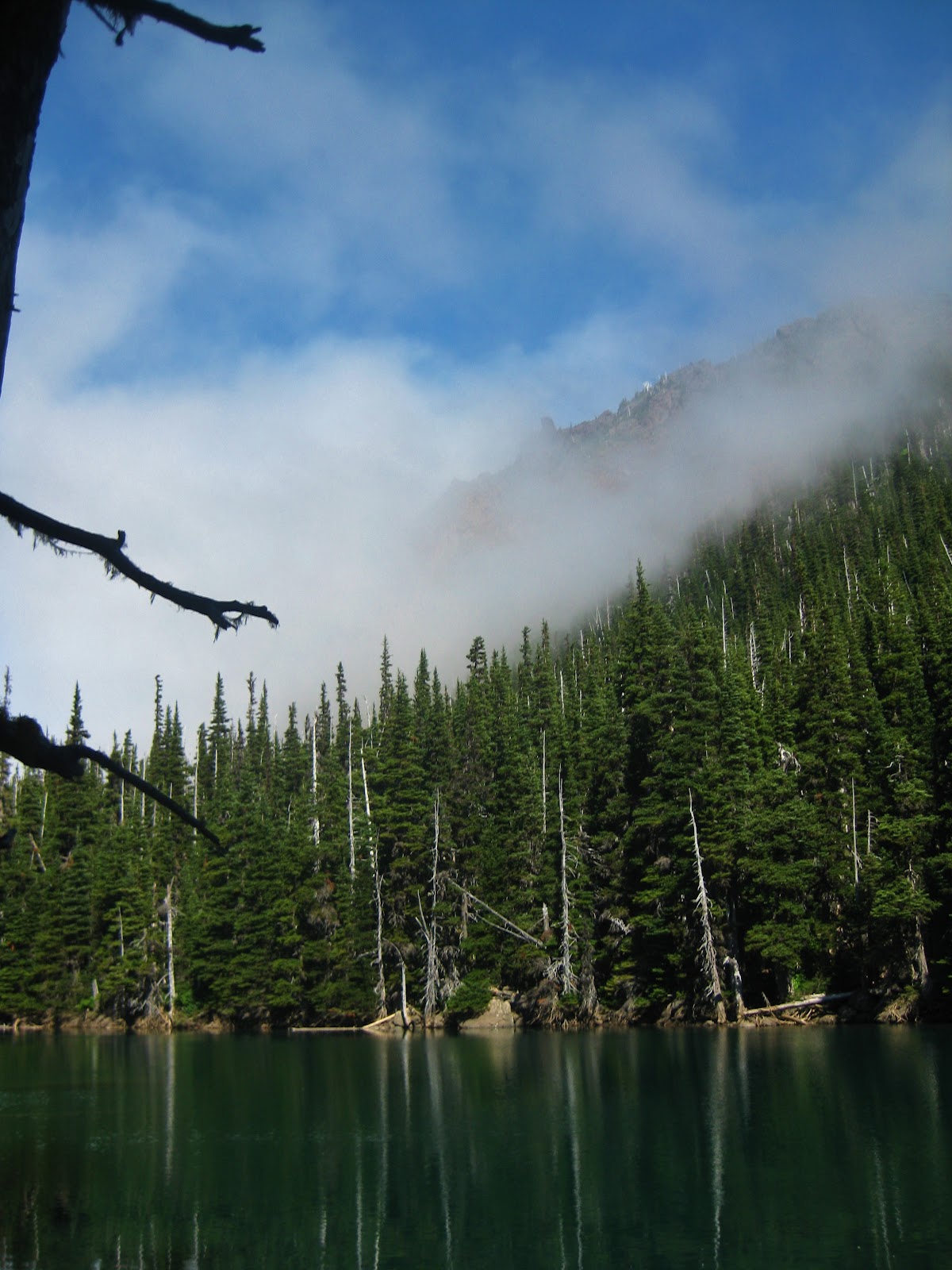 |
| Fog Rolling in on Lake Buckhorn |
After a dip, we sat around and chatted about nearly every topic under the sun until we looked down the valley and saw what at first looked like the dust raised from a massive rockslide. Paranoia over a disaster soon left and we were covered in a thick fog, leaving our sunny, reflective lake to look uninviting and cold. We hustled up to the campsite, quickly set up the tent and hunkered down for the night. We sat around and talked while eating dinner, battling mosquitos that were immune to all forms of insect repellent. The highlight of these little buggers came when I sprayed Deet on the back of my hand and watched as 2 mosquitos landed directly where I had sprayed and proceeded to bite me. Apparently, around Lake Buckhorn, the smell of Deet is to mosquitos what lower back tattoos are to frat guys: easy targets. The fog never cleared, and by 9pm it was dark enough to call it a night and head to bed. Sleeping on the ground in my tent, my muscles ached a bit, but I was starting to finally feel alive again after months of inactivity.
 |
| Cold Morning at lake Buckhorn |
The next morning was cold, but nothing too bad. Our camp site had survived the night (no real surprise) and after a great oatmeal breakfast, we packed up and left our lakefront home of the evening. Our next camp was 5 miles away at Boulder Shelter, which was over Buckhorn Pass (6500ft) then to Marmot Pass (6000ft) and ending up down in the valley to the campsites at Boulder Shelter, which is at 4500ft. This isn’t a difficult trek, but with highs in the 90s, we needed to beat the heat of the day.
 |
| Buckhorn Pass way in the Distance |
This is where the story started, with us slowly working our way up to the crest of Buckhorn Summit. The sun beating down on us, we were silent as Charlie Chaplin films until I lifted my head and saw, for the first time on this hike, the interior of the Olympic Mountains over the ridge. The feeling of excitement that washed over my body took away all the small aches and pains and my pace sped up to nearly a jog, as I was eager to climb out on a rock and see the view for its entire splendor.
 |
| Partial view from Buckhorn Pass |
The view from the pass was invigorating, and exactly why I love the Olympic Peninsula and the Olympic Mountain range. This is the place where my soul feels at ease, where all the problems of the world are of no concern, because all that is important is the moment that I am in, the moment where my eyes dart over mountains and valleys and gaze upon waterfalls, rivers and far off peaks that are begging to be climbed. This is the view that I want for eternity, one that while back in the city, I often drift back to and day dream about as a smile crosses my face.
To be continued....
Friday, August 10, 2012
Broken Camera, Broken Campaign..Healed Soul: A story of Murhut Falls and Politics
 |
| A great day hike! |
Sometimes, when you aren’t expecting it, an incident on a climb can be insight on future events on your life. The following tale is exactly that. A great idea, derailed by unforeseen reasons that I still can’t comprehend.
A few weeks ago, I took a well-deserved day off from my other job and took a day trip to take some pictures. I only had an afternoon, so I drove along Highway 101 and went to Murhut Falls. Having never been there in the summer, I was eager to finally climb around on the rocks and not have to worry about the ice killing me. I was also eager to get away and be calm, because the job in politics I was working was just about giving my 31 year old body a heart attack.
 |
| Behind Murhut Falls |
Hopping in my car, loaded up three different cameras, I drove as fast as I could to get to the trail head. I was excited because I had a plan that I had been dreaming about for months. I was going to get footage and pictures of my GoPro waterproof camera going over the waterfall and had just the plan. Using a carabineer, climbing rope and a GoPro Head mount, I was going to set it for time lapse and allow the water to carry it over the edge. To me, this was sound logic, considering these cameras and used on all sorts of crazy, dangerous adventures.
 |
| Sex and Meth at the Falls...or so I read |
I arrived at the trailhead and pretty much jogged the ¾ of a mile it took to get to the falls. I signed in (and saw some amazing sign-in comments) and worked my way down to the falls. Wearing my minimalist shoes, or toes shoes as I call them, I climbed down to the water and waded in. Months of snow run off had cooled the water, numbing my usually sore ankle. I took some pictures from water level and then started to accomplish my goal. I took pictures behind the falls, under the water looking up at the falls, and even pictures of me, being showered on by the upper falls. It was incredible and I was excited to see the uploaded result. However, I still had a mission to accomplish.
 |
| Shattered Case...thanks GoPro |
 |
| Where the best pictures were coming from |
Hooking the head mount to a climbing rope, thanks to a fantastic carabineer, I soon had the ability to have a camera dangling over the lower terrace of the waterfall. With the rocks along the edge of the falls somewhat (read as VERY) slick, I decided to gently toss the camera in the upper area and have it get swept over the edge. The first gentle toss, and I mean gentle in the way that you toss a kitten onto your bed from a few feet away, landed perfectly, getting swept away and over the edge, falling with the water until the rope it was attached to got tight. I pulled in the rope, noted that it had taken 15 pictures and decided to try it again. This time, it went even better and I could see the light on the camera flash as it was in the tumbling falls. Pulling it back up, I figured I would do it one more time and call it a day. I tossed the camera gently, just like the other 2 times, but this time, the corner of the shatterproof, waterproof case the camera was in split open. Watching in horror, the camera went over the edge, matching what might stomach was doing in my body. I pulled the rope back up, expecting a miracle, but soon saw that a $300 camera with some amazing pictures was now at the bottom of a waterfall. I climbed down, hoping maybe it would float up. I saw Nothing, Nada, Zilch. Beyond distraught and nearly crying, I ended up copying a scene from the movie A Christmas Story. Swearing loudly and drawn out, I was crushed.
 |
| Me, after seeing my camera go bye bye |
 |
| Lower Murhut Falls |
I ended up taking more pictures with the other 2 cameras I brought and called it a day. Driving home I called GoPro to complain, but since it was no longer under warranty, I would have to buy a new one. I went online, cried to my friends and followers and ended up receiving a donation to cover the cost of a new one. The day that had all the potential in the world, ruined by who knows what, was turning out to be ok. This is how the rest of my life has been.
 |
| A great day Campaigning |
For the past few months, I have been busy trying to help a man get elected who I feel would be an amazing representative. We slaved away for months, doing things that no other campaign had done and breaking records in contacting individuals at an unprecedented level. We had all the hope in the world for this Tuesday’s primary elections in the state of Washington. We knew we wouldn’t win, but all we needed was second place. We had planned so well, met our goals and now it was up to the people, the voters, to tell us what was going to happen. Just like my shatterproof camera case, my dreams that night were broken. The hope of a better tomorrow faded away, and just like my camera, my stomach again sunk to a new low. The feeling of not reaching a peak, the feeling of shattering my shoulder while walking my dog during a wind storm, the feeling of knowing that no matter what the victory, a victory feels good still evades me. The election and the camera were totally unrelated events, yet, I find similarities in both. Losing the camera made me realize that my supports for this company are amazing and wonderful. Losing the campaign made me realize that I have a new family and that no matter what, I believed. In both events, the picture of everything in my head is much more beautiful than it would have been with my camera or with a win. These events allow me to still say what if, to still imagine, and to still dream and set goals to make them a reality.
Thanks for reading and now, back to the hiking and trail guides.
Douglas Scott
Exotic Hikes
Subscribe to:
Posts (Atom)